Viewing
The viewing interface is implemented following the Web Map Tile Service (WMTS) as well as the Web Map Service (WMS) standards. Both services are implemented by a wide range of client software which makes it as simple as possible to integrate the viewing service as needed.
Service endpoints optimized for performance as well as for flexibility are provided alongside each other. Concrete example URLs demonstrating the capabilities of the various endpoints are provided in the chapter Sample Service Requests.
Performance optimized service
The performance optimized service variant is provided under the path
/cache/ows.
This endpoint offers access to predefined visualizations via WMTS and WMS. The GetTile as well as GetMap requests are answered from image tiles cached on object storage when possible. Figure 38 below shows the three predefined visualizations, true color, false color, and NDVI of the same image tile and Figure 39 the unmasked and masked versions using the validity mask of one tile.
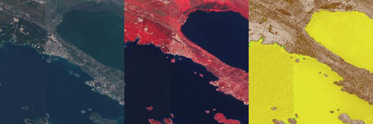
Figure 38 WMTS Tiles - True color, false color, and NDVI
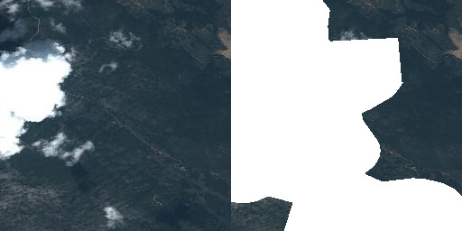
Figure 39 WMTS Tiles - Unmasked and masked
The operator might configure additional layers besides the default ones. These layers can offer a specific customization described below as performance optimized variant.
For example for the VHR Image 2018 dataset not only the three default layers for True Color, False Color, and NDVI are configured but also the Masked Validity one as shown in the figures above.
In addition the VHR Image 2018 dataset contains level 1 and 3 products. Thus individual layers aggregating each level individually are added making the total of offered layers twelve.
Finally two layers are configured offering a quick true color visualization of the entire level 3 datasets without support of the time dimension both unmasked as well as masked. The masked layer is shown in Figure 40 below.
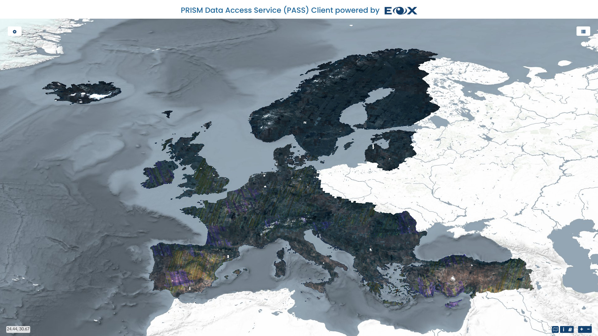
Figure 40 Web Client - Full coverage layer
Image tiles not yet present in the cache are stored upon first hit for consecutive requests. This is the so-called on-demand caching. The operator might decide for optimal performance, even for the first request, to pre-seed the cache. Also a mixed variant with a partly pre-seeded cache for example up to a certain zoom level is possible.
However, this is done fully transparent to the users and the only impact is that they might need to wait slightly longer when they are the first to visualize a certain product.
This service offers access on collection level only. Individual products can be
addressed using the time parameter given that they do not cover one another
on the time axis.
The best performance is offered at the WMTS interface which serves images tiles as they are cached without the need of any reprocessing. WMS responses are generated on-the-fly from image tiles and might thus need some reprocessing to stitch together and scale image tiles.
Cache WMS endpoint usually configures a maximum pixel size of the resulting rendered image.
More sophisticated reprocessing like reprojection or custom color adjustments are not offered at this endpoint.
Flexible service
The other service variant offered is optimized for the best possible flexibility
and can be accessed at the path /ows?. There are no server limits imposed
on the pixel size of the rendered images on the flexible endpoint.
This endpoint offers the following customizations via WMS:
Access to individual products via ID (
cql=identifier='ID')Access to entire collections/datasets supporting
timeparameterVarious layers as defined by the Earth Observation Application Profile of WMS (EO-WMS) like one showing outlines of products (
__outlines)Additional useful layers like one showing both, products and outlines, correctly rendering topology of outlines (
__outlined) or one showing a validity mask (__validity) or applied validity mask (___masked_validity)Numerous styles for layer where feasible like outlines or NDVI (
layers=ID__NDVI&STYLES=coolwarm)Reprojection to operator configured coordinate reference systems
Color adjustment via custom linear stretch
dim_range=<low-red-or-grey>
<high-red-or-grey>[,<low-green> <high-green>,<low-blue> <high-blue>]
Selection of named bands from registered coverages to use in rendering in the order red,green,blue of the final RGB image
dim_bands=nir,red,greenfor False color renderingFiltering of products to render into collection/dataset visualizations via Common Query Language (CQL) for example
&cql=cloudCover<1All other standard WMS parameters like
transparent,format, etc.Eligible products (vhr15/ua2012 and some Emergency products) when configured allow special rendering
TRUE_COLOR_PANSHARPENEDto perform on-the-fly pansharpening.Specifying rendering variables via vendor WMS parameter like in case of DEM__hillshade rendering:
VARIABLES=alg=ZevenbergenThorne,azimuth=315,altitude=45,zfactor=1.
All these customization parameters can of course be combined as needed.
Please see the chapter Sample Service Requests for detailed examples of all supported parameters.
Continue reading to learn about the provided Searching services.